
Something amazing happens in the parking lot of an east-end community centre every Friday afternoon. At around three thirty, a white, unmarked delivery truck would pull up with a bounty of fresh fruit and vegetables, all of which would be handed out to local residents free of charge. Strangely, there is no advertising, no poster or write-up about its existence anywhere, not even in the community centre out front. In fact, I only stumbled upon it while visiting the centre and saw the commotion out back through the large window facing the parking lot.
I made my way into the snowy lot to check it out, but the operation was drawing to a close that day. A trio of women who were helping to unload the truck into the hands of those huddled around the tailgate told me that a generous man was behind the food drop.
“He lives in there,” said a black woman with a thick Caribbean patois, pointing to the public housing project just in front of us.
“He has a food business,” explained a Bengali woman in a red hijab. “That’s where he gets all the food.”
Before I knew it, a third woman, a native of Eritrea, had prepared for me a bag full of tomatoes, broccoli and different kinds of melons. I refused to take it, but she insisted, saying that there was a lot of leftovers.
I learned that he was a private man; a low-key local who preferred to let his good deeds do the talking. I was immediately intrigued by this mystery man. Who was he and what’s his story? But on the long subway ride back into downtown Toronto that day, I began to ponder broader questions, about what the food truck might reveal about the socio-economic realities of the residents, and about the service gaps in the neighbourhood that might have created the need for it in the first place. I decided to return the following Friday.

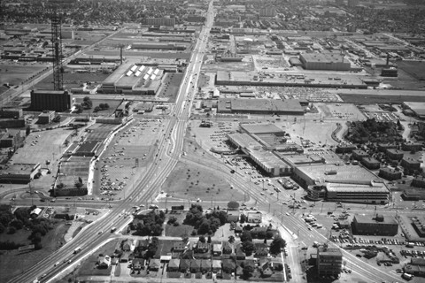
Oakridge is one of 72 neighbourhoods within the Toronto Central LHIN, part of the East Toronto Sub-Region. It is the LHIN’s eastern most neighbourhood, bounded by Warden Avenue to the east and Victoria Park Avenue to the west, and stretches from the railway tracks just south of Danforth Avenue to Taylor Massey Creek which snakes diagonally across the north, giving the neighbourhood its characteristic rip saw appearance from the air.

Oakridge is home to the first public housing project in Scarborough, and only the third of such developments in pre-amalgamation Metropolitan Toronto. Built in the early 1960s, the Cataraqui/Firvalley public housing complex occupies the thin wedge of land at the northern tip of Oakridge. It is flanked by three highrise apartment buildings at one end, and row upon row of townhouses at the other, all operated by Toronto Community Housing. The parking lot I visited sits in the middle of this complex.
But it’s not the only public housing development in Oakridge. Just one kilometre southwest of here is another complex operated by Toronto Community Housing, called Teesdale, with two more highrises. Cataraqui/Firvalley and Teesdale, while not very far apart on paper, are actually cut off from one another by a large ravine and the TTC subway line, which runs above ground in this part of town.
The rest of Oakridge is a mix of local businesses dotting Danforth Avenue, and mostly working-class bungalows erected during the post-World War II period when this part of Scarborough was a hive of industrial activity. Back then, the “Golden Mile”, a massive industrial park immediately to the north, was humming: the General Motors assembly plant churned out Chevy vans, Frigidaire made refrigerators, and Inglis built automatic washers and dryers. Other manufacturing powerhouses that had set up shop here included Thermos, Alcan and General Electric. And many of the Golden Mile’s workers made Oakridge their home. But things started to go south, literally, by the nineteen eighties and early nineties, punctuated by the closing of the General Motors plant in 1993 and its relocation to Flint, Michigan.
With a third of Oakridge made up of recent immigrants, few present-day residents have ties to this bygone era. However, the long shadow casted by the collapse of the area’s manufacturing base is still very much visible. Unemployment is high, at 17.1%. There are large swaths of former industrial lands that remain undeveloped, like the one just across the street from Cataraqui/Firvalley, roughly where the Becker’s Milk plant once stood. And with the nearby industrial park gone, and being so far away from any major highway, the neighbourhood no longer offers the location advantages it once did, especially for the middle class.
The majority of Oakridge’s current residents were not born in Canada. Twenty percent are from Bangladesh, plus smaller but sizeable populations from the Philippines and other parts of South Asia and Africa.
Today, Oakridge is among the most challenged of the 72 neighbourhoods in the Toronto Central LHIN. To get a picture of just how bad things are here, take a look at these indicators:
Unemployment rate: 17.1% (rank: 72 of 72)
Persons on social assistance: 22% (rank: 69 of 72)
Persons living below the low-income measure: 36.2% (rank: 68 of 72)
Persons with diabetes: 14.7% (rank: 72 of 72)
Persons with high blood pressure: 25.2% (rank: 72 of 72)
Mental health visits: 11.2% (rank: 69 of 72)
Persons with COPD: 11.5% (rank: 68 of 72)
Rate of hospitalizations per 1000: 93.6 (rank: 69 of 72)
Staggering. And you can’t help but think about the relationships among all of these factors — the “social determinants of health.”

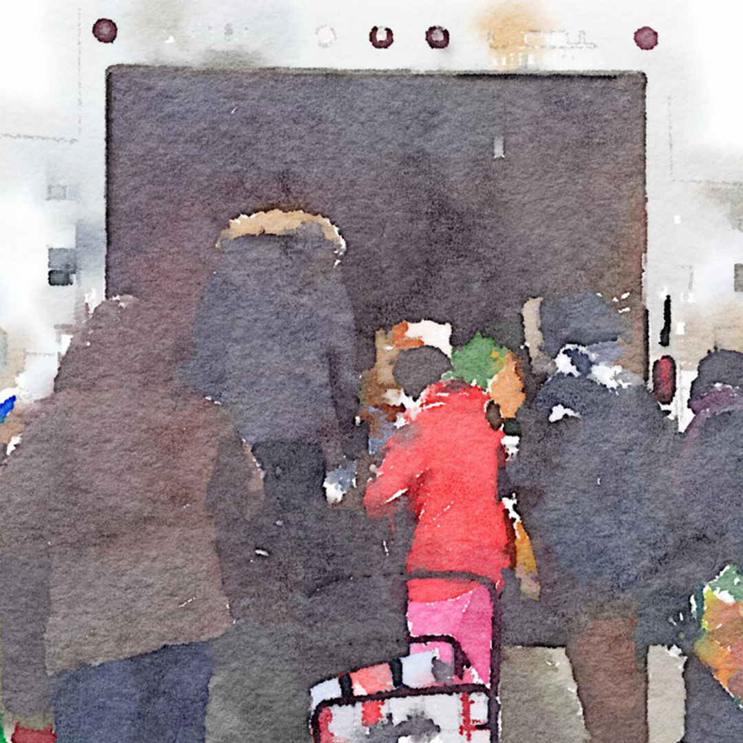
Just two days before Christmas, on an unusually warm December day, I made my return trip to Oakridge. I arrived shortly after three in the afternoon, and saw that a small cluster of people had already formed by the same spot in the southwest corner of the parking lot where the food truck had been the previous Friday.
There was a Muslim mother with her young daughter; an East Asian man, probably in his late sixties, with a banged up shopping cart; a white couple, each with an open can of beer in hand, inebriated and loud. And of course, there was the trio of women I had spoken with the previous week — from Saint Vincent, Bangladesh and Eritrea. And people were trickling in from the street, some drove up by car, and others appeared from the wooded area to the north.
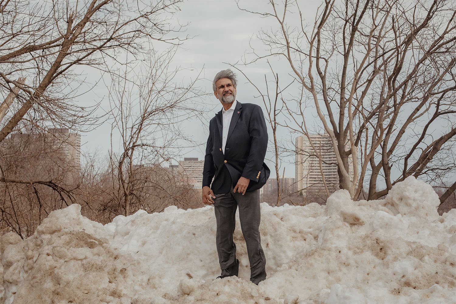
Their heads turned as a white truck appeared at the mouth of the parking lot, and panned with it as it slowly made its way over. When the truck finally came to a complete stop, a South Asian man, probably Pakistani or Afghan, in work boots and a khaki vest emerged from the cabin. He was probably in his mid-fifties, but the weathered complexion and a smoky voice made him seem older. I went over to speak with him, certain that he was the mystery man I was looking for.
At first, he was suspicious of who I was. He pulled out a bunch of receipts from his wallet to convince me that that the produce was legitimately purchased. I explained to him that I was not the authorities, just someone from Toronto General Hospital interested in learning more about his initiative and what it means to the community. That helped ease some of his anxiety.
He said that he had been living in Cataraqui/Firvalley for fifteen years. The truck is part of his food delivery business. He explained that whenever there is excess produce that customers don’t need, he would buy them and bring them here. He said that he’s done all right for himself, and wants to help others — the single mothers with young children, especially.
What he’s referring to is the problem of food insecurity — the inability to afford sufficient food because of inadequate income. With a third of families headed by a lone parent, Oakridge’s youth are particularly vulnerable to the effects of food insecurity. It’s well known that children from food insecure households are more likely to have poor health, and are more likely to go to the hospital. And because food insecurity affects their academic performance, the disadvantage they currently experience will unfortunately follow them throughout their life course.
A significant proportion of Oakridge’s population is on social assistance, 22% to be exact. But food prices have been on a steady rise over the past decade, especially the prices of fruit and vegetables. Every year, Toronto Public Health calculates the cost of a “Nutritious Food Basket” that feeds a family with a basic, healthy diet. The cost of a nutritious food basket in Toronto has increased every year since 2006, outpacing increases in minimum wage and social assistance rates. Today, a single mother with three children on social assistance living in Toronto would have about $100 left to spend on food each month, after paying her rent.
Oakridge also has the highest rates of diabetes and high blood pressure in all of the Toronto Central LHIN. These happen to be the chronic conditions for which nutritional self-care is critical for proper disease management. But if you can’t afford nutritious foods, you’re likely to choose less healthy and inexpensive alternatives, or to skip meals altogether. The reality for many is that the grocery budget is often sacrificed in the face of other necessities such as rent, childcare and utilities. Not surprisingly, food insecurity is known to be especially problematic for people with diabetes and high blood pressure, and can exacerbate the negative effects of their already diminished health and wellbeing.
The other segment of the Oakridge population most affected by food insecurity is seniors. The trio of women working the food truck told me that they knew quite a few seniors in the two apartment buildings operated by Toronto Community Housing, at 40 Cataraqui Court and 682 Warden Avenue. They would often visit them and drop off some of the produce because many of the seniors seldom leave their apartment.
Food insecurity is also very costly for the health care system. A recent study published in the Canadian Medical Association Journal found that health care costs for those who are food insecure are up to 121% higher than for those who are food secure.
Compounding the food insecurity issue is how difficult it is to get to a supermarket around here. The term food desert is often used to describe areas with relatively few nearby supermarkets, and Cataraqui/Firvalley is definitely one of them.
“Look around,” said the man with the food truck. “There are no grocery stores here.”
And he wasn’t exagerating. Wandering around the area that afternoon, I couldn’t help but notice how little commercial activity there was around Cataraqui/Firvalley. No supermarket, no convenience store, not even a fast food restaurant within a 20-minute walk of here. The closest supermarket is Sun Valley, which is at the corner of Danforth Road and Birchmount Road, two kilometres away by car, if you have one.

I visited Sun Valley and spoke with a young man working in the produce department. He happened to live in Cataraqui/Firvalley.
“You can get here by bus,” he said. “You take no. 135 Warden going south, then transfer to no. 113 Danforth going kinda north again.”
He prefers just cutting through the residential streets by foot, which is also a zigzag route, but generally faster. But he acknowledged that for someone not as able-bodied as him, lugging a week’s worth of groceries home might not be the most pleasant experience.

Back in the parking lot of the community centre, I began to understand why things are the way they are.
“There used to be a store there a long time ago,” said the woman from Saint Vincent, pointing at the plaza across the street from the parking lot. “But too many break-ins all the time and it closed down.”
The plaza is now entirely medical — a walk-in clinic, pharmacy, diagnostic lab and physiotherapy clinic.
She told me that local residents had advocated for a supermarket to be built on the patch of the land close to where the Becker’s Milk plant used to be, just on the other side of Warden Avenue. They were obviously not successful.
Between 1995–2005, the City of Toronto undertook an extensive study and urban planning project to figure out what do with the 68 hectares of former industrial lands along Warden Avenue left by the decimated Golden Mile industrial park. The land included the area around the old Becker’s Milk plant. In June 2005, City staff organized a day-long workshop and invited 40 participants from the community to discuss options for the redevelopment. Here’s how Ryerson University’s Centre for Urban Research and Land Development summarized the results of the day:
“The Workshop participants identified the need for new development in the Warden Corridor to include a variety of commercial uses such as a grocery store, ground floor convenience retail, a bakery, and restaurants (including a pub) and cafes on the basis that the new community should be well served by supporting commercial amenities, and the sense that the existing surrounding communities are lacking in these amenities.”
The City, to its credit, listened to the locals, and subsequently re-zoned the land as “mixed use” consisting of residential and commercial developments, with specific reference to the need for a supermarket. Here’s what the City of Toronto’s official land use plan for the area says:
“Large-scale, stand-alone retail stores and/or “power centres” are not permitted with the exception of a retail food store (supermarket) in a location south of the Utility Corridor, designed to serve the local population.”
The location south of the Utility Corridor refers to the area around the old Becker’s Milk plant.
Today, a decade after the project broke ground in 2006, the redevelopment is generally viewed as a success by urban planners. The majority of the 68 hectares of former industrial lands have now been filled in, mostly by newly constructed semi-detached homes and townhouses. These were spearheaded by major developers like Monarch Corporation and Mattamy Homes. The one exception is the parcel just across the street from Cataraqui/Firvalley — near the old Becker’s Milk plant. This patch of land is now more wilderness than industrial in appearance. But it’s an orderly kind of wilderness, with grasses left to grow to their natural height behind a chain-link fence, padlocked shut for who knows how long now, waiting for developers to show up. But none has.
Actually, that’s only partially true. In 2006, Loblaws had proposed the construction of a No Frills food store at that very location. There was to be two new buildings: a 3,659-square metre No Frills, and a smaller building of 1,139 square metres for other retail. People in the Cataraqui/Firvalley community had high hopes for the project, but no one I spoke with knew exactly why it never happened.

A little further into my conversation with the man with the food truck, I asked him for his thoughts on local issues that health planners need to think about. That’s when his tone changed. He began to cite one by one the community engagement activities that he had personally been a part of, and how little progress has resulted from them. He didn’t want to talk anymore at that point, and I don’t blame him. After saying our goodbyes, he trekked up the snowy embankment adjacent to the parking lot and disappeared into one of the many rows of townhouses that make up Cataraqui/Firvalley.
More from this issue

The Local Wins Eight Media Awards
Editor-in-Chief Tai Huynh was recognized for his exemplary leadership in journalism on a night of big storytelling wins for The Local

Meet the 2025 Local Fellows
We’re thrilled to introduce this year’s Local Journalism Fellows: Moyo Lawuyi, Vikram Nijhawan, and Mayumi Ramos.
At Toronto’s Catholic Schools, Students Twice as Likely to Opt Out of Mandatory Measles Vaccine
In the midst of a measles outbreak, data analysis by The Local finds that 15 of the 20 schools with the highest vaccine exemption rates are in the Catholic boards.
Understanding the TDSB’s Budget Woes in Five Charts
The province says the school board has a spending problem. The board says it’s chronically underfunded. We sort through the numbers.
The Local Earns CJF Jackman Award Nomination and Six Digital Publishing Award Nods
Nominations include recognition for General Excellence in Digital Publishing for the fifth consecutive year.
The Local Earns 8 Nominations at the National Magazine Awards
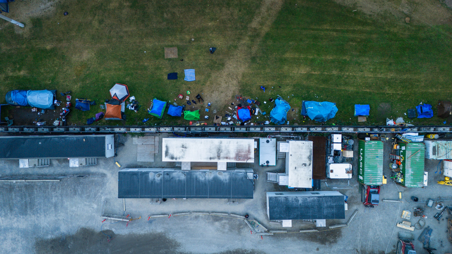
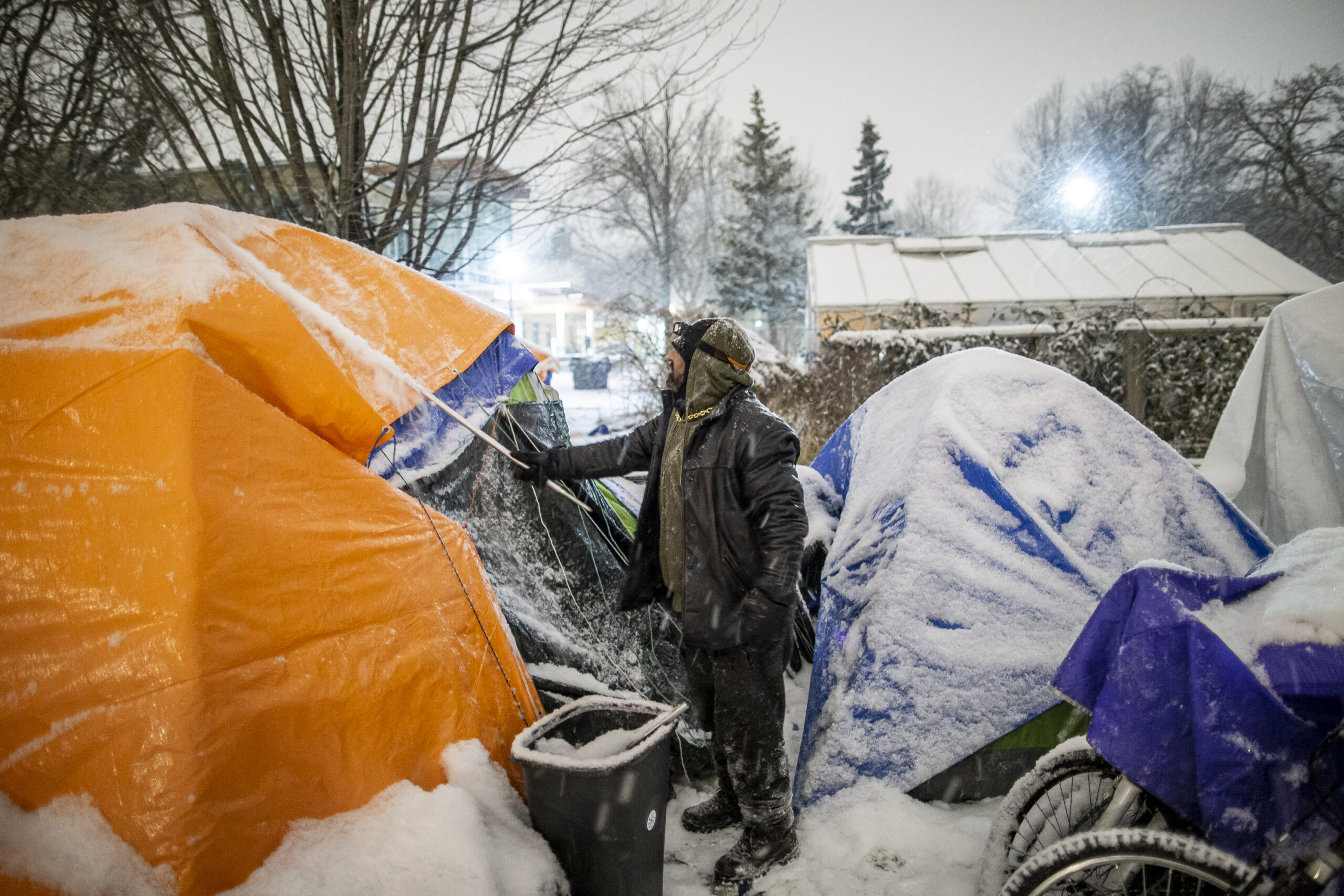
Our nominations, tied for the third most overall, recognize stories on everything from life expectancy to encampments to waste management to the bereavement industry.
Results from The Local’s Annual Diversity Survey
Every year The Local conducts a diversity survey among staff and contributors. See how we did in 2024
‘It’s Never-Ending’—Another By-Election in Don Valley West
Candidates for TDSB trustee in Ward 11 are up against winter weather and election fatigue in a ward that will have four votes in less than a year.
Have You Thought About Becoming a Board Member for a Local Organization?
We are looking for motivated and thoughtful individuals to join our volunteer board of directors.
The Local Journalism Fellowship 2025
Now in its fifth year, the program provides training and mentorship to aspiring and emerging journalists from communities underrepresented in Canadian media. Applications are now open.